About This Race
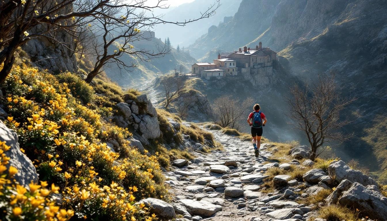
The 90K distance at Oh Meu Deus by UTMB travels through Portugal's Serra da Estrela, the highest mountain range in continental Portugal. The course traces ancestral trails connecting schist villages—traditional settlements built from the region's characteristic layered stone. Runners navigate paths that have served as trade and shepherding routes for centuries, passing through landscapes shaped by both geological forces and generations of rural mountain life. This distance serves runners who have completed several ultramarathons and want to explore technical mountain terrain without the extended recovery time of the 166K route. The pacing demands differ from more familiar ultra distances, requiring steady navigation through variable terrain while managing effort over a full day in the mountains. As part of the UTMB World Series, the race draws an international field to a region less traveled than Europe's alpine destinations. The May timing coincides with late spring conditions in the Serra da Estrela, when the high country transitions out of winter but weather can still shift quickly at elevation.
The route moves through the Serra da Estrela's network of traditional trails, connecting villages built from schist stone that blends with the surrounding geology. Runners travel on paths ranging from maintained trails to rougher mountain tracks, navigating terrain that reflects both the region's volcanic and glacial history. The course passes through areas where shepherding and small-scale agriculture continue, offering glimpses of rural mountain life that has adapted slowly to modern times.
Elevation Profile
Elevation profile estimated from terrain data. Actual course may differ.
The course gains 1,330m over 90km, with the steepest section between km 161–km 161.
Location
Practical Info
May in Serra da Estrela brings variable spring conditions with cool temperatures at elevation, potential for rain, and occasional strong winds. Weather can shift rapidly in mountain terrain.
The race base is in the Serra da Estrela region. Lodging options range from village guesthouses to small hotels in nearby towns. Early booking is recommended, particularly for UTMB World Series events that draw international fields.
Best For
Notable Features
The race showcases Portugal's highest mountain range, a region known more for its winter ski station than trail running. The schist villages represent a distinct architectural tradition tied to local geology, with entire settlements constructed from stacked stone without mortar. The ancestral trail network predates modern infrastructure, offering routes through landscape that has changed gradually rather than dramatically over centuries. The UTMB World Series designation brings international attention to terrain that remains relatively undiscovered in the broader trail running community.