About This Race
The 166K represents the flagship distance at Oh Meu Deus by UTMB, spanning the breadth of central Portugal's mountain ranges in a single push. This ultra-distance route connects three distinct mountain systems—Serra da Estrela, Serra do Açor, and Serra da Lousã—demanding sustained effort across varied terrain and extended time on feet. The course threads through schist villages and ancient shepherd paths, offering runners a full immersion in the cultural landscape of Portugal's interior highlands. This is a race for experienced ultra-runners comfortable with multi-day pacing strategies and self-sufficiency between aid stations. The technical nature of the terrain requires careful foot placement and navigation skills, particularly during night sections. Cutoff times are structured to allow for steady progress rather than speed, rewarding patience and proper fueling over aggressive early pacing. The 166K serves as a proving ground for runners building toward longer mountain ultras or seeking a challenging standalone objective in Portugal's less-traveled ranges. The route showcases the full character of central Portugal's mountains without the crowds found in more established European ultra destinations.
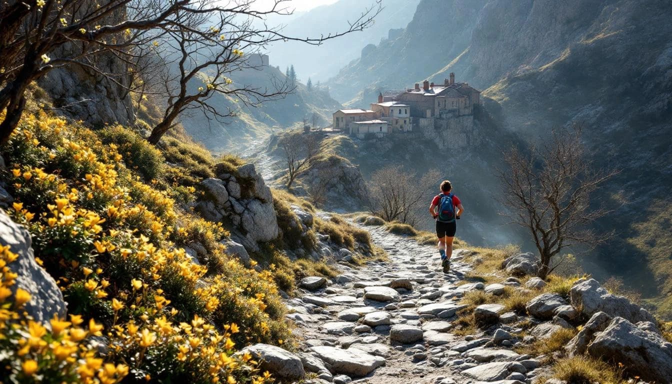
The route traverses three mountain ranges in sequence, moving through ecological zones that shift from granite peaks to schist formations. Terrain varies from rocky ridgeline trails to forested hillsides and narrow passages through traditional villages. Navigation follows a combination of marked footpaths and lesser-used shepherd routes, with sections passing through protected natural areas managed by Portuguese conservation authorities.
Runners encounter both runnable sections on established trails and technical passages requiring careful attention to footing. The course connects historic pathways that have linked mountain communities for centuries, passing through landscapes shaped by traditional agriculture and seasonal grazing patterns.
Elevation Profile
Elevation profile estimated from terrain data. Actual course may differ.
The course gains 1,082m over 166km, with the steepest section between km 261–km 261.
Location
Practical Info
May conditions in central Portugal typically bring mild temperatures at lower elevations with cooler, potentially wet weather at higher altitudes; runners should prepare for variable conditions across elevation zones and overnight sections.
The race base is accessible from Porto and Lisbon, with local accommodation options in the surrounding mountain towns; early booking recommended as lodging capacity in the rural areas is limited during race weekend.
Best For
Notable Features
The race offers access to three distinct Portuguese mountain ranges in a single continuous route, providing cultural immersion through working schist villages rarely visited by international runners. As part of the UTMB World Series, the event maintains international standards for course marking and aid station support while preserving the character of Portugal's interior mountain trails.