Trail running course through mixed terrain in Bern, CH
Eiger Ultra Trail by UTMB

Eiger Ultra Trail by UTMB 15K

15K·800m gain·Grindelwald, Switzerland
mountainhigh altitudetechnicaltrailqualifier

AI-generated image

Distance15K
Gain800m
Date15 Jul 2026
Difficulty2/5

Registration is closed for Eiger Ultra Trail by UTMB 15K

Get alerted if spots open up or when next year's registration goes live.

About This Race

The 15K strikes an ideal balance for runners seeking a substantial trail challenge without the ultra-distance commitment required for longer courses at this event. This distance allows runners to experience the technical alpine terrain and elevation changes that define the Grindelwald region while maintaining a pace that lets them fully appreciate the dramatic mountain scenery surrounding the Eiger North Face. Perfect for experienced trail runners looking to test themselves on demanding Swiss alpine trails or as a stepping stone toward the longer UTMB World Series distances offered here.

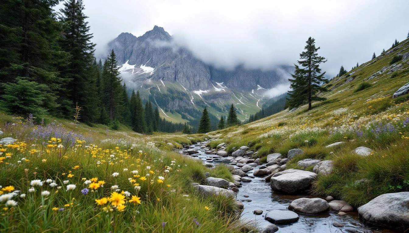
This 15K surprise course offers 800 meters of elevation gain, providing participants with an element of discovery in their Alpine adventure. The shorter distance allows runners to focus on enjoying the spectacular mountain environment and Swiss trail running culture.

Location

Practical Info

Nearest Airport

ZUR - Zurich Airport

Accommodation

Summit packages with guaranteed race entries and hotel stays were offered in cooperation with local Grindelwald accommodations, though these are currently sold out.

Best For

mountain runnersultra runnersinternational travelersexperienced trail runners

Notable Features

This UTMB World Series event takes place in a UNESCO World Heritage region beneath the iconic Eiger north face, offering runners the chance to traverse some of the most spectacular Alpine terrain in Switzerland. The multi-day format accommodates everything from pleasure runs to ultra-distance challenges, all set against the backdrop of one of mountaineering's most famous peaks.

Other Distances at This Event

16K

The route begins in Grindelwald and climbs into the network of trails that connect the valley's mountain stations and alpine huts. Expect a combination of wide mountain paths used by hikers and narrower singletrack sections that require technical footwork. The course design emphasizes the vertical nature of this landscape, with climbs that gain altitude steadily rather than gradually, and descents that demand controlled technique on uneven surfaces.

35K

The course departs Grindelwald and climbs through mixed forest before emerging into alpine pasture with views across the Lauterbrunnen valley. Runners traverse high trails beneath the Eiger's north wall, passing through terrain where rock, grass, and snow meet. Technical sections alternate with runnable alpine track, demanding both climbing fitness and descent control. The route returns to Grindelwald through different valleys than the ascent, completing a loop that showcases the region's varied alpine environments.

51K

The course explores the terrain surrounding Grindelwald, moving through a landscape shaped by glacial valleys and limestone ridges. Runners encounter the mixed surfaces typical of Swiss mountain trails: maintained hiking paths, rocky sections requiring careful foot placement, and alpine pasture crossings. The route profile reflects the vertical nature of the Bernese Oberland, though specific elevation details are not currently published. Grindelwald sits at approximately 1,034 meters elevation, and the surrounding trail network extends both higher into the peaks and lower into adjacent valleys. The mid-July timing means runners face full summer conditions at altitude, with potential afternoon weather changes common in the Alps.

101K

The route explores the trail network surrounding Grindelwald, moving through multiple valleys and alpine zones in the Jungfrau region. Runners encounter the characteristic features of Swiss mountain trails: well-maintained but steep switchbacks, occasional technical sections across scree or root systems, and passages through high alpine meadows. The course typically includes sections with views of the Eiger, Mönch, and Jungfrau peaks, though weather conditions in the mountains can limit visibility. Aid stations follow UTMB standards, positioned at strategic intervals with both nutrition and staffing designed for mountain ultra distances. The mixed terrain requires versatile mountain running skills—comfortable descending on technical surfaces, efficient climbing on sustained grades, and the ability to adjust pacing across varied footing throughout the distance.

250K

The 250K course loops through the Bernese Oberland, connecting Grindelwald with surrounding valleys and alpine passes in a route that showcases the full character of Swiss mountain running. Runners move through diverse ecosystems, from flower-filled meadows and larch forests to exposed ridgelines and glacier-carved terrain. The route includes multiple significant climbs and descents, with technical sections demanding careful foot placement and sustained concentration. Aid stations are spaced according to UTMB standards, but runners should expect longer stretches of self-sufficiency than in shorter formats. Navigation skills are essential, particularly if weather deteriorates or if running through the night. The course passes through traditional Swiss villages where local support adds energy to difficult moments, though much of the route unfolds in wild, remote terrain where runners must rely entirely on their own preparation and resolve.