About This Race
An out-and-back 100-mile course through the Colorado Rockies, run entirely above 9,200 feet with a high point of 12,600 feet at Hope Pass. Leadville is as much a battle with altitude as it is with distance, and its belt buckle finish awards are among the most recognized in ultrarunning.
The course is deceptively simple in structure: an out-and-back from Leadville to the turnaround at Winfield, crossing Hope Pass in both directions. What makes it relentless is the altitude. Starting at 10,152 feet in the old mining town of Leadville — the highest incorporated city in North America — runners are already at the limit where altitude begins to significantly affect performance. The first 40 miles follow a mix of road, jeep track, and trail along the valley floor before the course turns toward Twin Lakes and the base of Hope Pass. The climb over Hope Pass (12,600 ft) is the crux of the race, made more memorable by the llamas that packtrain supplies to the Hopeless aid station on the far side. After the turnaround at Winfield, runners face Hope Pass again, this time in the dark for many, before the long return to Leadville. The course is less technical than other Colorado hundreds but the altitude is unrelenting. Runners who live at sea level should plan for significant acclimatization time. The Leadville Trail 100 holds a special place in ultrarunning history — it helped establish the sport in America and its sub-25-hour and sub-30-hour belt buckles remain coveted achievements.
Elevation Profile
The course gains 15,748 ft over 100 miles, with the steepest section between mile 30–mile 35.
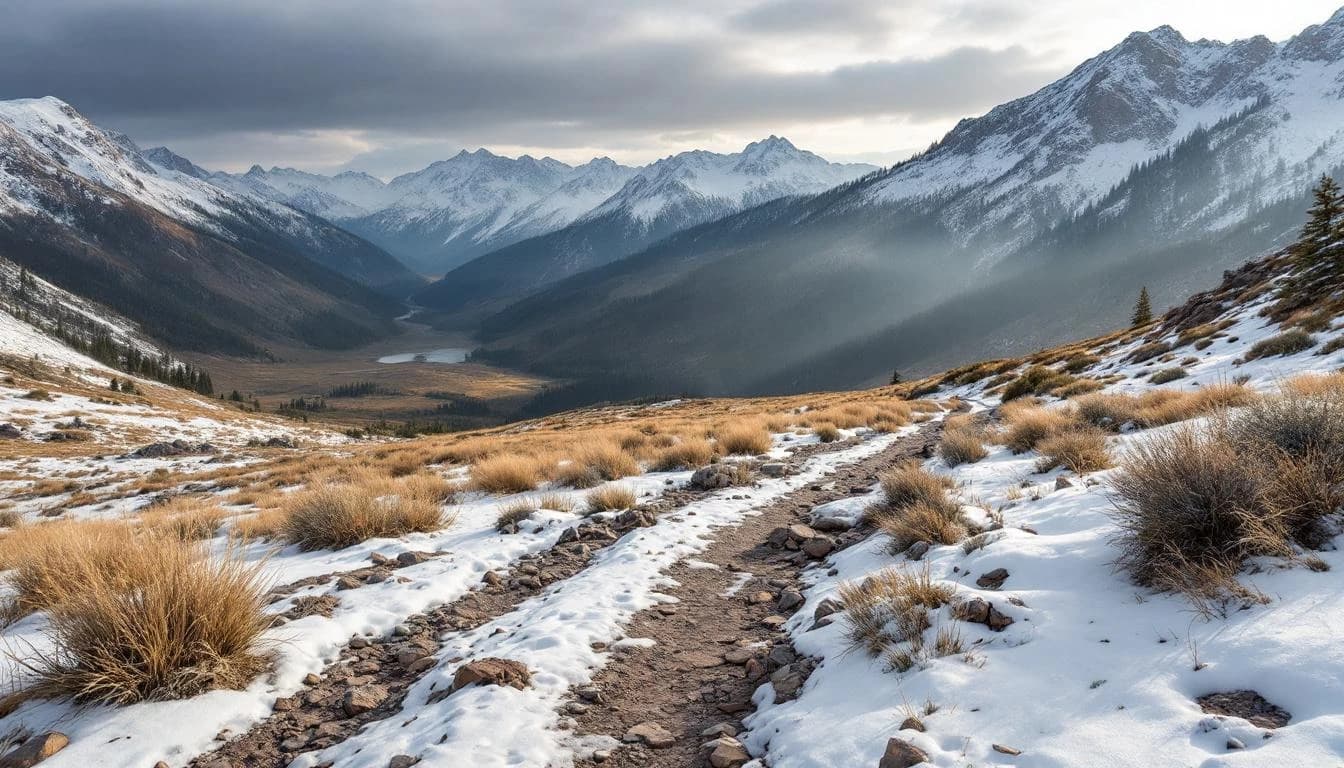
Course Map
Route shown is approximate and for illustration purposes.
Aid Stations
7 stations along the course
May Queen
water, food, electrolyte, medical
7h cutoff
Lakeside location. First crew point.
Outward Bound
water, food, electrolyte
11h cutoff
Twin Lakes (outbound)
full aid, medical, hot food
16h cutoff
Base of Hope Pass. Major crew access.
Hopeless (Hope Pass summit)
water, snacks
19h cutoff
Summit aid station. Llama-supplied.
Winfield (turnaround)
full aid, medical, hot food
20h cutoff
Turnaround point. Strict cutoff.
Twin Lakes (inbound)
full aid, medical, hot food
24h cutoff
Second crossing. Back from Hope Pass.
May Queen (inbound)
water, food, medical
28h 30m cutoff
Last crew point before finish.
Race History
2024 Results
Starters
Finishers
Winning Time
Median Time
Practical Info
High-altitude Colorado summer. Days warm (60–75°F) with intense sun, nights cold (30–45°F). Afternoon thunderstorms are common and can be severe above treeline on Hope Pass.
Denver (DEN) — about 2.5 hours drive, or Eagle County (EGE) closer
Leadville has limited hotel rooms. Many runners rent cabins or stay in nearby Frisco, Buena Vista, or Copper Mountain. Arrive early for altitude acclimatization.
- headlamp
- reflective vest
- rain gear
Best For
Notable Features
Hope Pass crossing (twice), out-and-back format, llama packtrain, coveted belt buckle finisher awards, Leadville mining town atmosphere
Prepare for This Race
GEAR GUIDE
The Best Hydration Vests for Ultrarunning in 2026
A tested guide to the best hydration vests for ultra marathons and long trail races — from lightweight racing vests to high-capacity mountain packs.
6 min read
RACE PREPARATION
Racing Western States: The Complete Preparation Guide
Everything you need to prepare for the Western States 100 — course strategy, essential gear, heat training, crew logistics, and what first-timers need to know.
7 min read
RACE GUIDE
The Hardest 100-Mile Races in the World
A look at the 100-mile races that push even the strongest ultra runners to their limits — what makes them brutal, and what draws people back.
3 min read
GEAR GUIDE
The Best Hydration Vests for Ultrarunning in 2026
A tested guide to the best hydration vests for ultra marathons and long trail races — from lightweight racing vests to high-capacity mountain packs.
RACE PREPARATION
Racing Western States: The Complete Preparation Guide
Everything you need to prepare for the Western States 100 — course strategy, essential gear, heat training, crew logistics, and what first-timers need to know.
RACE GUIDE
The Hardest 100-Mile Races in the World
A look at the 100-mile races that push even the strongest ultra runners to their limits — what makes them brutal, and what draws people back.