About This Race
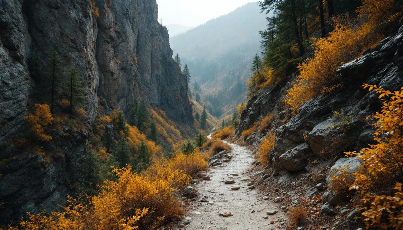
The Euchre Bar Massacre is not a race for the faint of heart. This free fatass-style event takes runners deep into the wild and scenic North Fork of the American River canyon, where well-marked trails give way to bushwhacking and route finding becomes as important as endurance. Limited to just 50 participants combined across both distances, this grassroots event embodies the spirit of old-school ultrarunning where community matters more than competition. The Massacre has earned its intimidating name through a decade of humbling runners. With roughly 10,000 feet of climbing for the 25-mile distance and 20,000 feet for the 50-miler, the course weaves through historic mining sites including Euchre Bar, Pioneer Mine, and Italian Bar. The terrain alternates between technical singletrack, off-trail scrambling, and navigation challenges that demand both physical and mental preparation. What sets this event apart is its philosophy: entry is free, but you must wait at the finish for at least one runner to complete their journey. This simple rule creates a supportive atmosphere where faster runners become impromptu aid station volunteers and cheering squads. The race director's honest assessment that previous 25-mile finishers have taken 14 hours while 50-mile runners needed 25 hours speaks to the event's uncompromising difficulty and the authentic challenge it presents to the California ultra community.
Starting and finishing at Shirttail Creek Campground near Foresthill, the course plunges into and climbs out of the American River canyon multiple times. Runners navigate historic mining trails including Euchre Bar, Pioneer Mine, Ebeneezer's Highway, Green Valley, Mumford Bar, and Italian Bar. The route combines established trails with significant off-trail sections requiring navigation skills and bushwhacking experience.
The canyon's rugged topography creates relentless elevation changes, with steep descents followed by equally punishing climbs. Runners pass through one aid station location twice during their journey, where drop bags and crew support are available. The race director deliberately withholds detailed course maps until the week before the event, adding an element of uncertainty that reflects the race's adventure-focused philosophy.
Location
Aid Stations
1 stations along the course
Drop Bag Station
Single aid station location that runners pass through twice during the course
Practical Info
SMF - Sacramento International Airport
Group campsite available for Friday and Saturday night at the race location.
Best For
Notable Features
This fatass-style event epitomizes grassroots ultrarunning culture with its free entry, intimate 50-person field limit, and unique finish line rule requiring participants to wait for fellow runners. The combination of technical terrain, significant bushwhacking sections, and navigation challenges through historic American River mining sites creates an adventure run that prioritizes exploration and community over speed. The race director's honest warnings about difficulty and the withheld course maps until race week add to the event's authentic, old-school ultrarunning character.