Trail running course near Chihuahua, MX
Chihuahua by UTMB

Chihuahua by UTMB 20K

20K·186m gain·
mountainhigh altitudetechnicaltraildesertqualifier

AI-generated image

Distance20K
Gain186m
DateDate TBA
StatusOpen
Difficulty3/5

About This Race

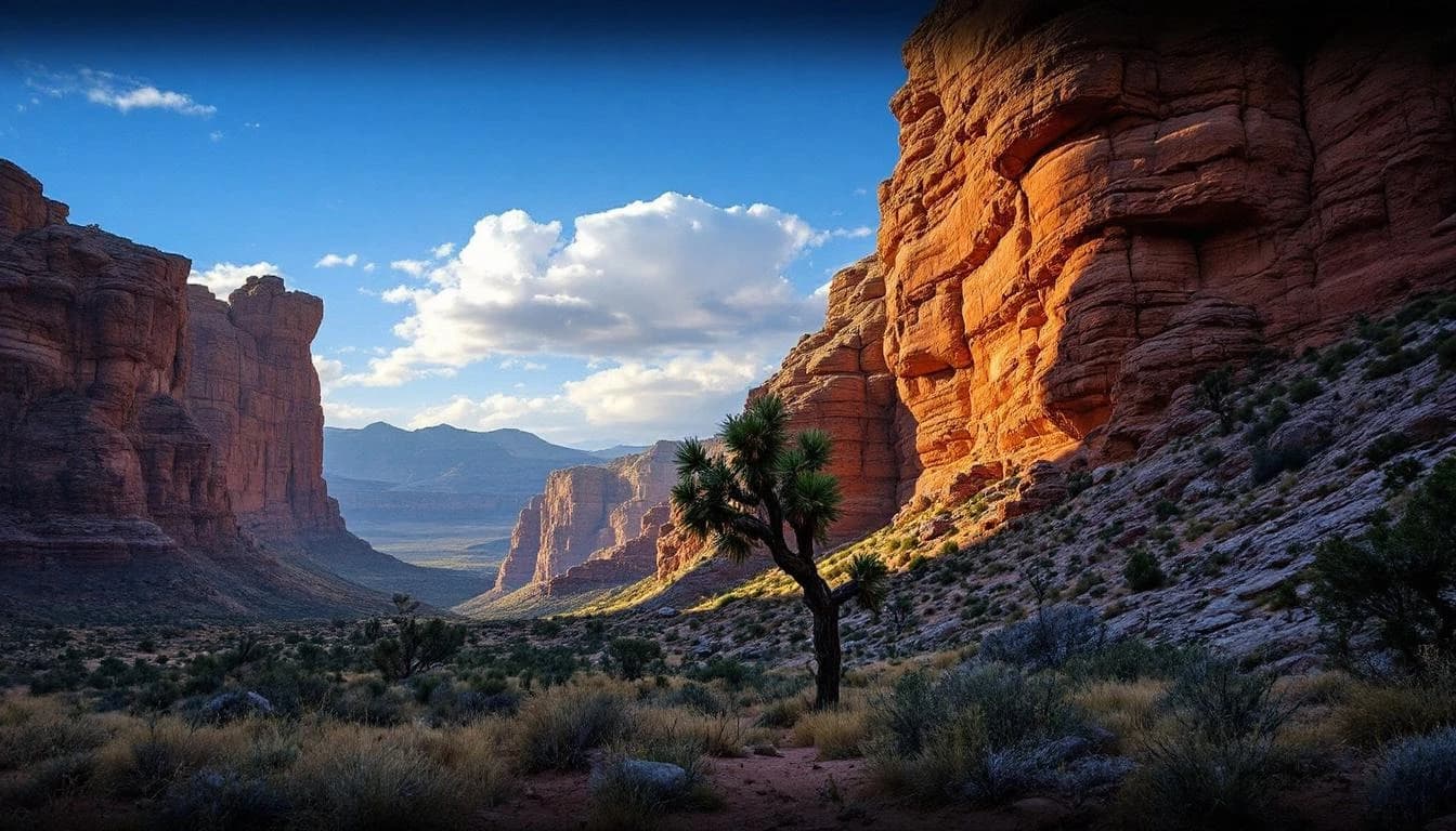
Chihuahua by UTMB's 20K serves as the gateway distance into Mexico's legendary Copper Canyon system, offering runners a genuine introduction to high-altitude trail running in Rarámuri territory. The course traverses the rugged landscapes near Chihuahua, where the terrain shifts between pine forest trails and exposed canyon approaches, providing a technical stepping stone for those accustomed to road racing or less technical trail environments. With 650 meters of elevation gain spread across the distance, this route demands respect without requiring the multi-hour endurance of ultra distances. Runners experience the distinctive feel of running above 2,000 meters elevation, where the thin air adds a layer of challenge even to moderate climbs. The race operates under UTMB's standards while honoring the cultural significance of running through lands long traversed by the Rarámuri people, known for their extraordinary distance running traditions. The 20K distance typically allows for a 2-4 hour experience, giving runners adequate time to absorb the canyon landscapes and cultural context without the strategic fueling and pacing demands of the longer race options. This makes it particularly well-suited for runners seeking their first UTMB-branded event or those wanting to explore the Copper Canyon region before committing to one of the ultra distances.

The route navigates mixed terrain characteristic of the Chihuahua highlands, combining technical trail sections with more runnable fire road segments. Runners should expect rocky footing, variable surface conditions, and the effects of altitude throughout. The 650-meter elevation profile provides sustained climbing rather than a single massive ascent, requiring consistent pacing and elevation awareness.

Elevation Profile

Elevation profile estimated from terrain data. Actual course may differ.

The course gains 186m over 20km, with the steepest section between km 32–km 32.

Location

Practical Info

Weather

Conditions vary significantly by season in Chihuahua's highlands; runners should prepare for strong sun exposure, potential afternoon storms during summer months, and cooler temperatures at altitude regardless of season.

Accommodation

Chihuahua city provides full lodging infrastructure ranging from budget to upscale options, with the race likely offering shuttle services or coordination for canyon-area logistics given the remote nature of the terrain.

Best For

ultra runnersinternational travel runnerscultural experience seekers

Other Distances at This Event

8.5K

190m gain

The 8.5-kilometer route serves as the event's most accessible option with just 200 meters of elevation gain. This distance welcomes runners of all levels to participate in the cultural celebration and experience the canyon setting without extreme physical demands.

38K

462m gain

The route traverses mixed terrain characteristic of the Chihuahua high desert, combining trail surfaces with technical sections that require careful footing. Specific course details including elevation profile, aid station locations, and cutoff times are managed through the official UTMB World Series registration and runner materials. The technical nature of certain sections suggests this isn't simply a runnable fire road course, though the exact balance of terrain types varies year to year based on course design.

59K

740m gain

The course explores the mixed terrain of the Sierra Madre, combining rocky singletrack with wider mountain paths through high desert landscapes. Runners encounter the region's characteristic red rock formations, pine forests at elevation, and expansive views across canyon systems. Technical sections demand attention to foot placement, while more runnable stretches allow for rhythm and recovery between challenging segments.

94K

649m gain

The course explores the Copper Canyon system through a mix of mining roads, indigenous footpaths, and technical singletrack. Runners move between ecological zones as the route descends into canyon sections and climbs back to forested ridgelines, with terrain ranging from smooth pine-needle trails to rocky, technical passages requiring careful foot placement. Water and aid station spacing reflects the remote nature of the region.

135K

1,157m gain

The 135K course explores the diverse terrain of the Sierra Madre Occidental, moving through pine forests, canyon systems, and high-altitude ridges. The mixed terrain alternates between runnable sections and technical passages requiring careful foot placement. Aid stations are spaced to account for the remote nature of certain course segments, with runners needing to carry mandatory gear and manage supplies strategically between stops.